survey mapper
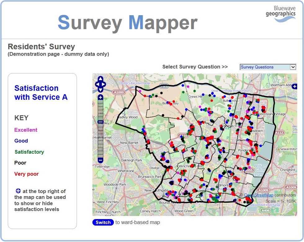
Survey Mapper is a web-based system for mapping survey response data
The system enables the interactive mapping of survey results, with the option to rapidly switch between survey questions.
Results can be displayed at the respondent level, or can be represented as thematic maps for selected geographical boundaries (such as wards).
The system would typically be used for the geographical analysis of results from a local authority residents' survey, mapping satisfaction levels for variables such as street cleaning, bin collection, parks and libraries.