research field maps
Research Field Maps are available as jpgs or PDFs and now online
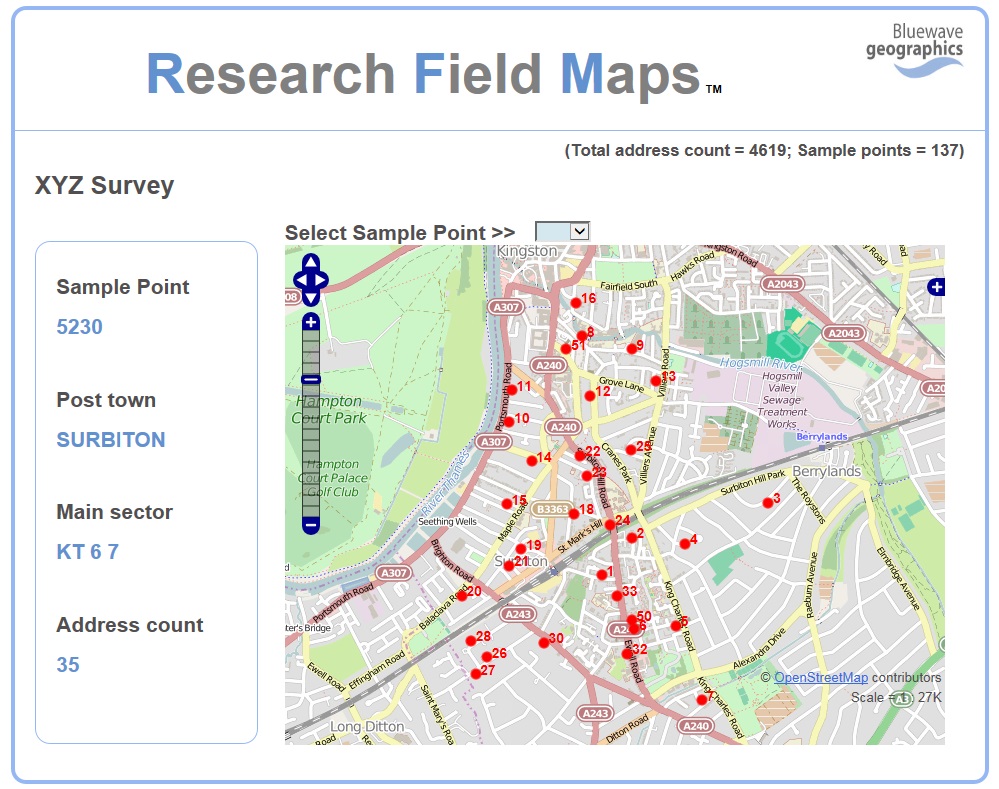
Research Field Maps from Bluewave Geographics are detailed maps for interviewers to enable them to more easily locate properties and sample point areas in the field.
The maps are available for both preselected address surveys and quota samples where the sample points are defined by boundaries.
Using our new online Research Field Maps facility interviewers can now view maps of their assignments on their mobiles and hand-held devices.
The online system can be configured so that interviewers can use unique logins and only see maps for their own assignments.
Take a look at our on-line Research Field Maps demo